Caminito del Rey Málaga

The Caminito del Rey: everything you need to know
Do you want to know how to get to the Caminito del Rey? How long the walk is? Here you can find out
everything you need to know before visiting the Caminito del Rey.
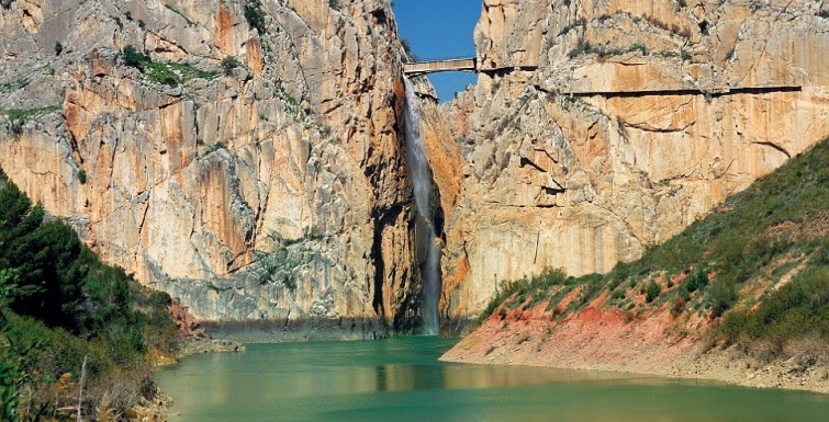
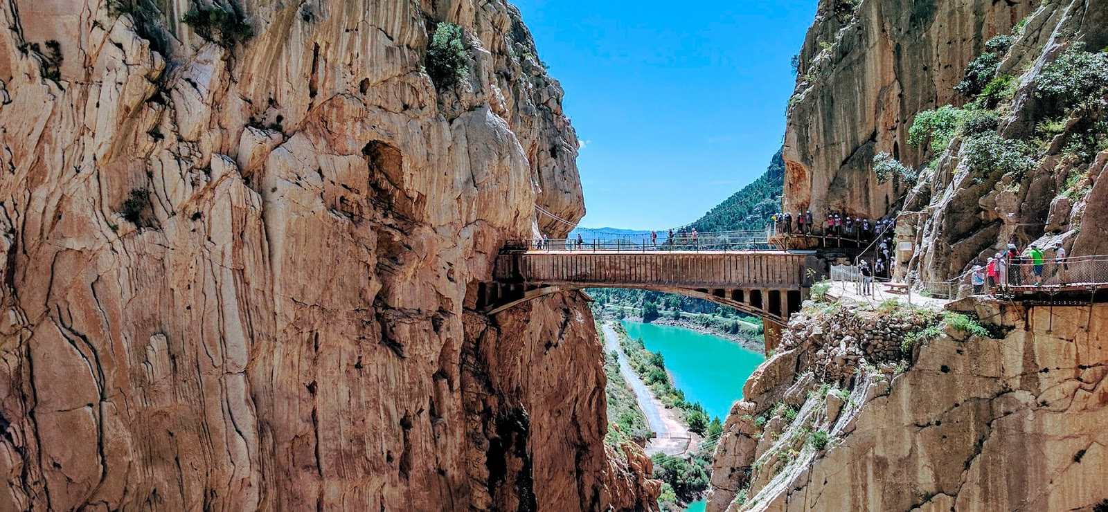
The Caminito del Rey Malaga is one of the best experiences the city has to offer. Located in the natural surroundings of
the Desfiladero de los Gaitanes, in the municipalities of Alora, Antequera and Ardales, the Caminito del Rey goes through one of the
most beautiful landscapes in the mountains of Malaga.
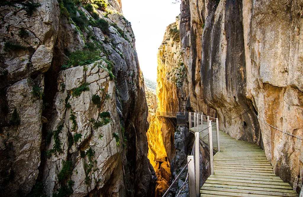
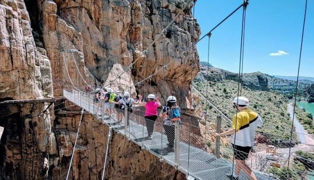
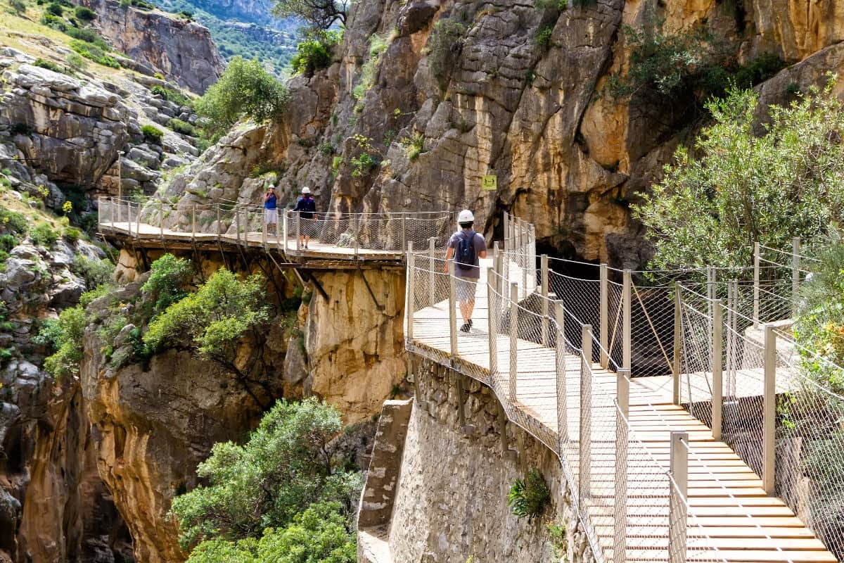
It is a path that is just one metre wide built into the walls of the gorge and that covers more than 3 kilometres. It hangs from the vertical
walls at an average distance of 100 metres above the river.
Before planning a visit to the Caminito del Rey, it is essential to get information about the route: how to get there, how long the walk takes and what its history is.
Source: www.caminitodelrey.info
Accessing the Caminito del Rey Malaga
Northern access
The northern access to the Caminito del Rey is located in Ardales, next to the Conde de Guadalhorce reservoir, near The Kiosk restaurant. Once you arrive at the northern entrance, there is a small stone tunnel and a 1.5 kilometre walk until you reach the control area, where groups form for the visit and the safety equipment necessary to for the visit is handed out. This route is known as the Senda de Gaitanejo.
Southern access
The area south of the Caminito del Rey is located close to the Estación de El Chorro (El Chorro station) in Alora and is actually where the route ends. Formerly it was possible to enter from both access points, but today there is only one entrance available in the northern area. If you come from the south you can park if you're driving and catch a bus shuttle that takes you to the official entrance of the Caminito del Rey.
Source: www.cadenaser.com
How to get to the Caminito del Rey
The Caminito del Rey Malaga can be accessed several ways:
How to get to the Caminito del Rey Malaga by car
From Malaga
To get to the Caminito del Rey from Malaga take the A-357 toward the MA-444, passing Cartama, Pizarra, Carratraca and Ardales. This route is almost 60 kilometres long and takes less than 1 hour.
From Pizarra you can also take the road to Alora and from there follow signs to the Estación de El Chorro (El Chorro Station) on the A-343. This route is a little longer and it takes just over an hour.
From Antequera
For all those who live in the area to the north of the Caminito del Rey Malaga, it is advisable to go to Antequera via the A-92 and from there take either of these two routes: go towards Campillos by the A-384 until you reach the El Chorro reservoirs, or in the direction of Valle de Abdalajís on the A-343, and from there go to El Chorro station.
From Ronda
It is also possible to access the Caminito del Rey from Ronda, coming from the province of Cadiz (A-367) until you get to Ardales and from there take the MA-5403.
Source: www.civitatis.com
How to get to the Caminito del Rey Malaga by train
There is currently only one Renfe line that goes to the Caminito del Rey. It stops at the southern entrance of the path and leaves from Malaga’s Maria Zambrano station, running every day.
The disadvantage of this option is the restricted timetable, with just one train in the morning at 10:05 a.m. and another in the afternoon at 16:48 p.m. The journey takes less than 50 minutes.
How to get to the Caminito del Rey Malaga by bus
Getting to the Caminito del Rey de Malaga by bus is perhaps the most complicated option, since you have to change in Alora. You have to take the M-231 from Malaga, which goes from Malaga to Pizarra via Alora. It runs every day of the week. Once arriving in Alora, you have to change and take the M-340 to the Caminito del Rey.
Source: www.caminitodelrey.com
The history of the Caminito del Rey
The Caminito del Rey Malaga was originally built because the Sociedad Hidroeléctrica del Chorro (El Chorro Hydroelectric Company)
needed access between the two waterfalls to allow the passage of the maintenance operators and the transport of materials.
The work was carried out by sailors from Malaga who were used to hanging from the ropes and masts of their boats. The work began in 1901 and ended in 1905, but it wasn't until 1921 that is was inaugurated by King Alfonso XIII. Since then, it came to be known as the Caminito del Rey and visits to the area started to become very frequent.
Over the years, the path has been used as a route for excursions by lovers of hiking, but the passage of time, deterioration and lack of maintenance made the path quite dangerous to walk. For this reason, rehabilitation work was carried out to make the Caminito del Rey accessible.
Source: www.mientrada.net
If you want to relax after walking the path, you can visit one of Malaga’s spa resorts, which are close to the Caminito del Rey, such as Carratraca